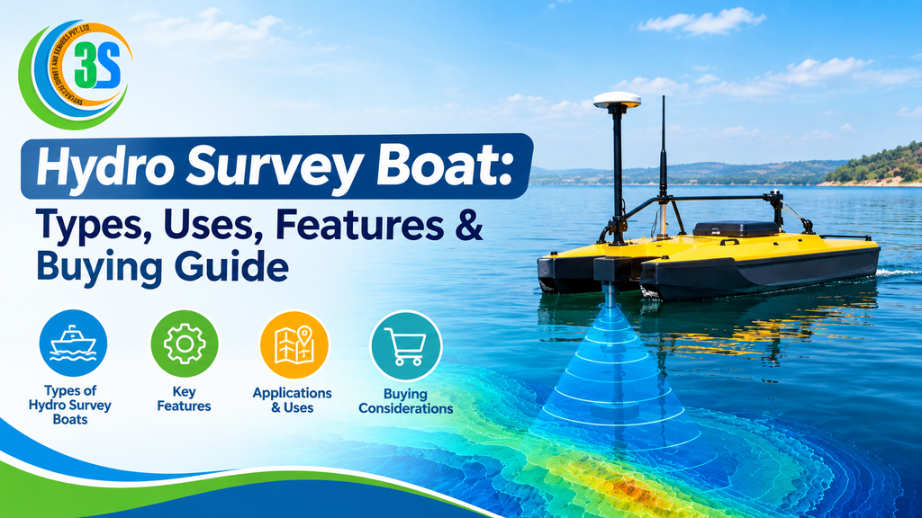
A hydro survey boat is a specialized watercraft used to measure water depth, collect underwater data, and perform hydrographic and bathymetric surveys. These boats are widely used for river mapping, reservoir surveys, dredging, dam inspections, and water resource management.
Modern hydrographic survey boats can be equipped with echo sounders, GNSS receivers, RTK positioning systems, and survey software to collect georeferenced depth measurements. Depending on the project, professionals can choose a traditional survey boat, a remote-controlled boat, or an unmanned hydro survey boat.
In this guide, we explain the types, applications, essential features, and important buying considerations for selecting the right hydro survey boat in India.
What Is a Hydro Survey Boat?
A hydro survey boat is a platform designed to carry surveying instruments across water bodies and collect data about underwater terrain. It helps surveyors measure water depth, identify underwater features, and prepare bathymetric maps.
A typical hydro survey boat may include:
- Echo sounder: Measures water depth using acoustic signals.
- GNSS receiver: Records the boat’s geographical position.
- RTK positioning system: Provides enhanced positioning accuracy when suitable correction services are available.
- Survey software: Collects, processes, and organizes survey data.
- Navigation system: Helps operators control the boat or follow planned survey routes.
The required equipment depends on the survey area, accuracy specifications, water conditions, and project objectives.
For related underwater mapping applications, explore Bathymetry Survey Services.
Types of Hydro Survey Boats
Different hydro survey boats are designed for specific surveying environments and operational requirements.
1. Traditional Hydrographic Survey Boat
Traditional hydrographic survey boats are operated by a crew and can carry multiple surveying instruments, including echo sounders and GNSS receivers.
Common applications:
- River and reservoir surveys
- Harbour and coastal mapping
- Dredging and construction surveys
- Waterway development projects
These boats are suitable when onboard personnel, additional equipment, or a larger working platform is required.
2. Unmanned Hydro Survey Boat
An unmanned hydro survey boat collects survey data without requiring an operator onboard. Depending on its capabilities, it may be remotely controlled or programmed to follow predefined routes.
Key benefits:
- Reduces the need for personnel onboard
- Can access certain shallow or restricted areas
- Supports repeatable survey operations
- Offers convenient deployment for suitable small and medium-sized water bodies
These boats are commonly considered for reservoir mapping, river surveys, and bathymetric data collection.
3. Remote-Controlled Hydro Survey Boat
A remote-controlled hydro survey boat is operated using a handheld controller or dedicated control station. Compact models can be useful for surveying ponds, canals, shallow rivers, and small lakes.
Depending on the model, these boats can carry depth sensors, GNSS receivers, and data collection equipment.
Before purchasing, check the control range, battery life, payload capacity, and compatibility with your required survey instruments.
4. Autonomous Hydrographic Survey Boat
An autonomous hydrographic survey boat uses navigation technology and software to follow planned survey lines with limited direct operator control.
Depending on its configuration, it may include GNSS positioning, route planning, obstacle detection, and automated data collection.
These systems are useful for repetitive surveys and larger projects, although their performance depends on navigation capabilities, environmental conditions, and operator supervision.
Main Uses of a Hydro Survey Boat
Hydro survey boats are used across several industries for underwater measurement and mapping.
1. Bathymetric Surveying
Bathymetric surveying measures water depth and maps the shape of the underwater surface. An echo sounder records depth measurements while a positioning system associates them with geographical coordinates.
The resulting data helps surveyors create bathymetric maps and understand underwater terrain.
Learn more about bathymetry and underwater mapping.
2. River and Reservoir Mapping
Hydro survey boats help map riverbeds, reservoir floors, and other underwater features. Survey results can support water resource planning, sediment assessment, and reservoir management.
3. Dredging and Construction Projects
Hydrographic surveys are important before and after dredging operations. Depth measurements help project teams assess excavation requirements and monitor changes in underwater levels.
4. Dam and Canal Surveys
Surveyors use hydro survey boats to collect depth data in dams, canals, and irrigation systems. This information supports infrastructure maintenance, sediment monitoring, and project planning.
5. Harbour and Coastal Surveys
Suitable hydrographic survey boats can support harbour and coastal mapping, including water depth measurement and the identification of underwater features.
Important Features to Consider When Buying a Hydro Survey Boat
Choosing the right hydro survey boat involves evaluating both the boat and its surveying equipment.
1. Positioning Accuracy
Check the GNSS or RTK positioning specifications and correction requirements. Reliable positioning helps associate depth measurements with accurate geographic locations, although it does not guarantee overall survey accuracy by itself.
2. Echo Sounder Compatibility
Confirm whether the boat supports a single-beam or multibeam echo sounder.
Single-beam systems are commonly used for depth measurements along survey lines, while multibeam systems collect depth information across a wider area.
3. Payload Capacity
The boat should safely support the echo sounder, GNSS receiver, batteries, communication equipment, and other required sensors.
Choose a platform with sufficient capacity for your intended configuration.
4. Battery Life and Operating Range
For unmanned boats, evaluate battery endurance, charging time, communication range, and expected operating time. Actual performance can vary with payload, speed, currents, and weather.
5. Navigation and Safety Features
Features such as route planning, emergency stop controls, low-battery alerts, and return-to-home functionality can improve operational convenience and safety.
6. Software Compatibility and Technical Support
Ensure that the equipment works with your preferred survey software and supports the required data formats.
Also consider installation assistance, operator training, spare parts, maintenance, and after-sales technical support.
Explore SuperTech Survey’s surveying equipment and services to learn about related surveying solutions.
Hydro Survey Boat Price in India
The hydro survey boat price in India depends on the boat type, sensor configuration, positioning technology, automation features, and software requirements.
A compact remote-controlled boat with a basic depth sensor will generally have different costs from a professional unmanned platform equipped with RTK positioning, advanced sonar, and automated navigation.
The main factors affecting price include:
- Boat size and payload capacity
- Single-beam or multibeam echo sounder
- GNSS or RTK positioning equipment
- Navigation and communication systems
- Survey software and accessories
- Training, maintenance, and technical support
For an accurate quotation, share your survey area, required accuracy, water conditions, and preferred equipment configuration with the supplier.
How to Choose the Right Hydro Survey Boat
Follow these steps before making a purchase:
- Define your application: Identify whether you need river, lake, reservoir, canal, harbour, or coastal surveying.
- Assess water conditions: Consider water depth, currents, obstacles, and accessibility.
- Select the instruments: Determine whether you need a single-beam or multibeam echo sounder and GNSS or RTK positioning.
- Compare boat types: Evaluate traditional, remote-controlled, unmanned, and autonomous platforms.
- Check data compatibility: Confirm that the equipment meets your survey software and output requirements.
- Compare total costs: Include accessories, software, training, maintenance, and support.
The best hydro survey boat is the one that meets your project’s technical requirements while providing dependable performance and practical operating costs.
Frequently Asked Questions About Hydro Survey Boats
What is a hydro survey boat used for?
A hydro survey boat measures water depth and collects underwater data for bathymetric mapping, river surveys, reservoir management, dredging, and hydrographic surveying.
Which equipment is used on a hydrographic survey boat?
Common equipment includes an echo sounder, GNSS receiver, RTK positioning system, navigation equipment, and survey data collection software.
Can a hydro survey boat operate in shallow water?
Yes. Certain compact hydro survey boats are designed for shallow-water applications. Check the boat’s draft, sensor installation, minimum operating depth, and suitability for local water conditions.
What is the difference between a hydro survey boat and an unmanned survey boat?
Hydro survey boat is a general term for a vessel used in hydrographic surveying. An unmanned survey boat operates without a person onboard and may be remotely controlled or capable of autonomous navigation.
How much does a hydro survey boat cost in India?
The price depends on the boat platform, sonar, positioning system, automation, and software. A supplier can provide a suitable quotation after reviewing your project requirements.
Conclusion
A hydro survey boat is an essential tool for underwater mapping, bathymetric surveying, and water resource projects. Traditional boats, remote-controlled platforms, unmanned vessels, and autonomous systems offer different capabilities for different applications.
Before purchasing, compare positioning accuracy, echo sounder compatibility, payload capacity, battery life, software integration, and technical support.
SuperTech Survey provides surveying equipment and technical support for professionals working in surveying and geospatial applications. Explore our bathymetry services and surveying services to learn more about relevant solutions for your projects.