
Choosing the right DGPS supplier in India is an important step for surveyors, construction companies, infrastructure developers, and geospatial professionals. A reliable supplier can help you select suitable surveying equipment based on your project requirements, accuracy needs, site conditions, and budget.
DGPS (Differential Global Positioning System) technology helps improve positioning accuracy by using differential corrections. Modern surveying workflows also use GNSS receivers that work with multiple satellite navigation systems, depending on the device’s supported capabilities.
If you are planning to purchase DGPS surveying equipment, this guide explains the essential features to check, applications, supplier selection criteria, and common buying considerations.
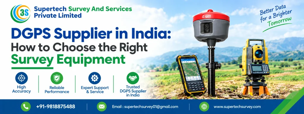
What Is DGPS Survey Equipment?
DGPS survey equipment uses satellite positioning data and correction information to improve positioning accuracy compared with standalone positioning. Depending on the equipment and correction method, it can support applications such as land surveys, topographic mapping, construction layout, and infrastructure development.
Modern DGPS/GNSS receivers may support RTK (Real-Time Kinematic) positioning, which can deliver centimetre-level positioning under suitable conditions. Actual performance depends on the receiver, correction source, satellite visibility, environmental conditions, and survey procedures.
Before choosing a DGPS supplier, identify whether your project requires a basic differential positioning system, an RTK-capable GNSS receiver, or another surveying solution.
How to Choose the Right DGPS Supplier in India
Selecting a supplier involves more than comparing equipment prices. Before making a purchase, take into account the following aspects.
1. Check the Supplier’s Experience and Product Knowledge
Choose a supplier that understands surveying equipment and can explain the differences between available models. The supplier should help you evaluate equipment according to your application instead of recommending a device based only on price.
Ask about product specifications, supported positioning methods, field operation, compatibility, and the availability of technical assistance.
2. Understand Your Accuracy Requirements
Different surveying projects require different levels of positioning accuracy. For example, preliminary mapping may have different requirements from engineering surveys or construction setting-out.
Before purchasing, clarify:
- Required horizontal and vertical accuracy
- Whether RTK or other correction services are needed
- Expected survey area and operating conditions
- Whether real-time results or post-processing are required
Always check the manufacturer’s specifications and understand the conditions under which the stated accuracy can be achieved.
3. Compare GNSS Receiver Features
A suitable DGPS/GNSS receiver should match your workflow and project requirements. Important features to compare include:
- Satellite tracking: Supported constellations and signals, such as GPS, GLONASS, Galileo, and BeiDou, where available.
- Correction compatibility: Support for the correction services or base-rover setup required by your project.
- Connectivity: Bluetooth, Wi-Fi, radio, cellular connectivity, or other supported communication options.
- Battery performance: Operating time suitable for your expected fieldwork.
- Environmental protection: Appropriate dust and water resistance for the intended working conditions.
- Controller and software: Compatibility with your data collection and surveying applications.
Not every receiver supports every feature. Verify the exact model specifications before purchasing.
4. Evaluate Technical Support and After-Sales Service
Surveying equipment is often used on time-sensitive projects, making technical support an important purchasing consideration.
Ask whether the supplier can assist with initial setup, configuration, operating instructions, troubleshooting, firmware updates, and warranty-related queries. Also confirm the availability of service support and replacement accessories.
A supplier who clearly explains these arrangements can help you make a more informed buying decision.
5. Compare Price, Warranty, and Included Accessories
The lowest-priced receiver may not always be the most suitable option. Compare the total package rather than the device price alone.
Check whether the quotation includes the receiver, controller, antenna where required, batteries, charger, carrying case, data collection software, and other necessary accessories.
Confirm warranty coverage, taxes, delivery charges, software licensing, and any recurring correction-service fees before placing an order.
Common Applications of DGPS Survey Equipment
DGPS/GNSS surveying equipment is used across several industries, including:
- Land surveying: Boundary surveys, land measurement, and site documentation.
- Construction: Site surveys, setting-out support, and infrastructure layout.
- Road and highway projects: Route surveys, alignment work, and topographic data collection.
- GIS and mapping: Geographic data collection and spatial mapping.
- Agriculture: Field mapping and compatible precision agriculture workflows.
- Infrastructure development: Surveying support for utilities, industrial sites, and development projects.
The appropriate equipment depends on the accuracy requirements, project scale, terrain, and data collection method.
DGPS vs GNSS Receiver: What Should You Choose?
DGPS refers to differential positioning, while GNSS refers to satellite navigation systems such as GPS, Galileo, GLONASS, and BeiDou. Although they are connected, these phrases have different meanings.
A GNSS receiver can use signals from multiple satellite constellations, while differential correction methods can improve its positioning performance. Some modern GNSS receivers support RTK and other correction techniques.
For professional surveying, choose a receiver based on its supported correction methods, achievable accuracy, compatibility, and intended application rather than relying on the product name alone.
Why Choose SuperTech Survey for Surveying Equipment?
SuperTech Survey provides surveying equipment and geospatial solutions for professionals with different project requirements. When evaluating equipment, customers should compare the available models, specifications, compatibility, and support options to identify a suitable solution.
If you are looking for a DGPS supplier in India, contact SuperTech Survey to enquire about available DGPS/GNSS receivers and surveying equipment. Share your application, required accuracy, project location, and budget to help identify suitable options.
Before finalising your purchase, request the relevant product specifications, quotation, warranty details, and technical support information.
Frequently Asked Questions (FAQs)
1. How do I choose the right DGPS supplier in India?
Check the supplier’s product knowledge, equipment specifications, technical support, warranty terms, and ability to recommend equipment suited to your project requirements.
2. What is the difference between DGPS and RTK?
DGPS is a differential positioning approach. RTK is a carrier-phase-based GNSS technique that can provide centimetre-level positioning under suitable conditions. Their accuracy and performance depend on the equipment, correction source, and operating environment.
3. What factors affect DGPS receiver accuracy?
Accuracy depends on the receiver and antenna, satellite geometry, correction method, signal obstructions, atmospheric conditions, and field procedures. Always review the manufacturer’s stated accuracy specifications.
4. What should I check before buying a DGPS receiver?
Check accuracy requirements, satellite and signal support, correction compatibility, battery life, software, connectivity, environmental protection, warranty, and technical support.
5. Where can I find a DGPS supplier in India?
You can contact SuperTech Survey to enquire about DGPS/GNSS surveying equipment, product specifications, and suitable options for your project. Confirm current availability and support arrangements directly with the supplier.
Conclusion
Choosing the right DGPS supplier in India starts with understanding your surveying requirements. Compare positioning accuracy, correction methods, receiver features, software compatibility, warranty, and after-sales support before making a decision.
By evaluating these factors carefully, surveying professionals can select equipment that meets their project needs and supports reliable field data collection. Contact SuperTech Survey to enquire about DGPS/GNSS equipment options for your surveying application.